St. Francis Dam Disaster Site
Site Information
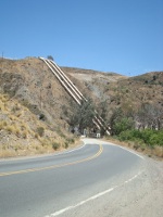
DescriptionOn March 12, 1928, just before midnight, the 185-foot concrete St. Francis Dam collapsed and sent over twelve billion gallons of water roaring down the valley of the Santa Clara River. Over 450 lives were lost.
MapLocation and Vicinity Map Detail Map View larger map on OpenStreetMap or Google Maps
|